
How to Choose the Right UAV Station for Your Needs?
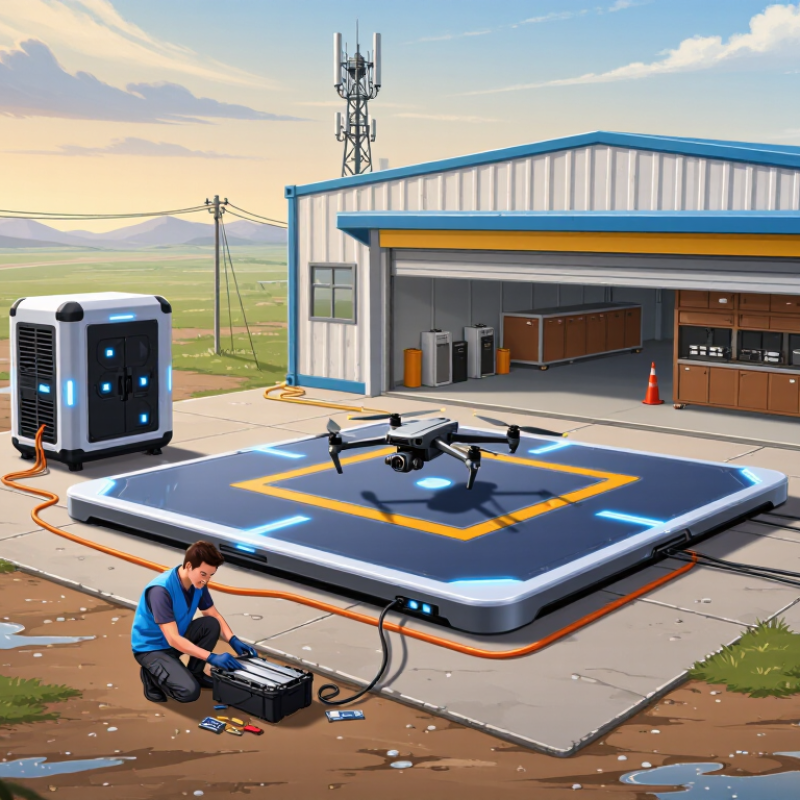
Choosing the right Uav Station is not simply a matter of comparing prices or selecting the newest model. It is a decision about mission reliability, operational safety, and long-term value. A station beside a warehouse may need rapid charging and precise landing. A remote inspection site may require weather protection, satellite communication, and dependable backup power.
Michael Huerta, former Administrator of the Federal Aviation Administration, said, “The key to unlocking the full potential of drones is safety.” That principle should guide every Uav Station evaluation. Buyers should examine launch accuracy, battery management, thermal control, data security, maintenance access, and compatibility with their existing aircraft. Regulatory requirements also matter. A technically capable station can still fail if its operation does not fit local aviation rules.
The best choice depends on real conditions. Dust, rain, poor network coverage, and uneven terrain can expose weaknesses that product brochures rarely mention. Field trials are essential. Small details matter, too. Can a technician replace a battery without special tools? Can the station report a fault before a scheduled mission? These questions reveal practical quality.
No solution is perfect. I have seen equipment appear efficient during demonstrations but become difficult to maintain after repeated outdoor use. This is why the selection process should include honest risk assessment, operator feedback, and measurable performance targets. The right station is not always the most powerful one. It is the one that performs consistently where your mission actually happens.
Define Mission Scope Under the FAA’s 400-Foot AGL and BVLOS Rules
How to Choose the Right UAV Station for Your Needs?
Define Mission Scope Under the FAA’s 400-Foot AGL and BVLOS Rules
Choosing a UAV station starts with the mission, not the hardware. Under FAA Part 107, a small unmanned aircraft generally must remain within 400 feet above ground level. Near a structure, the permitted height may relate to that structure’s upper limit. This detail matters on uneven terrain, where a flat map can hide a steep elevation change. A station should support accurate terrain awareness, dependable position data, and clear flight records.
BVLOS operations require closer review. Standard Part 107 operations generally require the remote pilot to maintain visual line of sight. A BVLOS mission may need an FAA waiver, exemption, or another applicable authorization. The station should therefore match the approved operating concept, not an ambitious future plan. Consider communication coverage, emergency landing areas, weather limits, battery reserves, and who will monitor alerts. Small gaps become serious during long routes.
Tips: Draw the route around real obstacles. Mark trees, towers, wires, and nearby people. Measure altitude from the ground below the aircraft, not only from the launch point. Check FAA requirements before each deployment, because guidance and authorizations can change. A useful station also keeps maintenance logs and records lost-link events. Perfect planning is unlikely. Review every flight and revise the mission scope when field conditions prove your assumptions wrong.
| Mission Profile | Typical Operating Area | Planned Flight Altitude | FAA Operating Condition | UAV Station Requirements | Connectivity and Safety Features | Recommended Station Configuration |
|---|---|---|---|---|---|---|
| Local Site Inspection | Industrial property, construction site, farm, or utility compound | Up to 400 feet above ground level (AGL), subject to the applicable operational limits | VLOS Standard Part 107 operations may be possible when the remote pilot can maintain visual line of sight and remains within all other applicable limits. | Weather-resistant enclosure, battery charging, landing-position accuracy, and a station footprint suitable for a fixed operating location | Reliable local communications, aircraft health monitoring, propeller and battery checks, emergency landing logic, and clear status indicators | Compact fixed station with automated takeoff and landing, scheduled missions, and manual pilot takeover capability |
| Repeated Corridor Inspection | Road, rail, pipeline, river, or transmission corridor extending beyond the immediate launch area | Normally planned below 400 feet AGL, while maintaining safe separation from people, structures, and obstacles | VLOS or Waiver A pilot must maintain VLOS during a standard operation. A flight that requires operation beyond VLOS generally needs an applicable FAA authorization or waiver. | Extended-range communications, route-recovery capability, multiple landing points or stations, obstacle data, and precise geofencing | Dual-link communications where appropriate, loss-link behavior, return-to-home or safe-hold logic, remote identification compliance, and redundant navigation inputs | Distributed station network with documented handoff procedures and a communications coverage assessment before deployment |
| Remote Infrastructure Monitoring | Remote substations, water facilities, communications towers, or isolated industrial assets | Up to 400 feet AGL, or within 400 feet of a structure when the operation meets the applicable FAA rule and safety conditions | Site-Specific Review The 400-foot limit is measured from the surface. Operations near structures must also address people, obstacles, airspace, and the specific limits of the applicable rule. | High environmental protection, temperature management, reliable power, lightning protection, secure access, and low-maintenance components | Cellular or other approved network connectivity, local weather sensing, battery temperature monitoring, tamper alerts, and automated fault reporting | Ruggedized station with environmental sensors, scheduled inspection routines, and a clearly defined remote-pilot escalation process |
| Emergency or Public-Safety Support | Disaster areas, search zones, flood areas, wildfire perimeters, or temporary incident sites | Mission-specific altitude selected below the applicable ceiling and adjusted for terrain, smoke, wires, cranes, and temporary hazards | Authorization Review Emergency conditions do not automatically remove aviation requirements. The operator should confirm the applicable rule, airspace status, and any required authorization before flight. | Rapid deployment, portable power, quick aircraft replacement, secure evidence handling, high-visibility status reporting, and straightforward operator access | Resilient communications, live video, encrypted data handling, high-accuracy position reporting, contingency plans, and battery logistics | Transportable station or trailer-based station with fast setup, manual launch capability, and operational procedures for degraded networks |
| Night Operations | Industrial sites, security patrol areas, agricultural properties, or infrastructure locations after sunset | Within the applicable altitude limit, with additional attention to lighting, obstacles, weather, and ground risk | Night Authorization Part 107 allows night operations when the applicable night-operation requirements are met, including required anti-collision lighting visible for the required distance. | Controlled lighting, low-light landing support, weather monitoring, secure perimeter access, and reliable night-time aircraft detection | Anti-collision light verification, infrared or low-light payload support, obstacle alerts, battery thermal monitoring, and automated abort rules | Enclosed station with lighting checks, preflight automation, night-rated sensors, and a documented procedure for visual observation and remote-pilot oversight |
| Operations Near People | Urban, commercial, event, campus, or worksite environments where uninvolved people may be present | Altitude alone does not determine compliance; the operation must also meet the applicable rules for people and moving vehicles | Risk-Based A 400-foot ceiling does not by itself authorize flight over people. The operator must satisfy the applicable category, conditions, or authorization requirements. | Reliable containment, precise navigation, controlled launch and recovery zones, access control, and payload safeguards | Geofencing, obstacle avoidance, low-battery diversion, emergency landing selection, Remote ID capability, and strong command-link monitoring | Station positioned inside a controlled perimeter, supported by a site-specific risk assessment and procedures that keep uninvolved people clear |
| Planned BVLOS Expansion | Large-scale asset networks or routes where the aircraft will leave the remote pilot’s visual line of sight | Usually designed within the 400-foot AGL ceiling unless a different approved operating condition applies | Specific FAA Approval BVLOS is not generally available under the basic VLOS requirement of Part 107. The operator should obtain the applicable FAA waiver, exemption, or other authorization before conducting BVLOS operations. | High-availability communications, detect-and-avoid capability appropriate to the approval basis, redundant systems, remote station supervision, and documented maintenance controls | Link-health analytics, independent aircraft tracking, contingency routing, lost-link procedures, cybersecurity controls, and complete flight logging | Scalable multi-station architecture designed around the proposed approval, safety case, communications coverage, and operational limitations |
| Operations Near Controlled Airspace | Locations near airports, heliports, military facilities, or other regulated airspace | Altitude must remain within the applicable operating limit and any airspace-specific authorization | Airspace Check The operator should review current FAA airspace information and obtain authorization when required before launching from the station. | Accurate station coordinates, configurable airspace restrictions, launch interlocks, current map data, and a clear authorization workflow | Geofencing, preflight airspace validation, authorization-record storage, position integrity checks, and automatic mission blocking when restrictions apply | Fixed station with validated coordinates, controlled mission approval, and software that prevents launch when the planned route conflicts with restrictions |
| Planning note: Under the standard Part 107 framework, the remote pilot generally must maintain visual line of sight, and the aircraft generally must remain at or below 400 feet AGL except where a specific rule or authorization permits otherwise. BVLOS operations require an applicable FAA approval pathway. Operators should verify current FAA requirements, airspace status, Remote ID obligations, aircraft eligibility, and site-specific hazards before selecting or deploying a UAV station. | ||||||